Historic environment and cultural heritage

Historic environment and cultural heritage are an important part of the history and development of the settlements surrounding the Solway, and continue to provide residents and tourists with snapshots into the rich and vibrant history of the area.

Cultural heritage was discussed briefly within the Coastal Change section, within the Physical chapter of the Solway Review. This discussion focussed primarily on the risk posed to cultural heritage from coastal change, both through accretion and erosion. This section will focus on activities and economic benefits of cultural heritage in and around the Solway.

The Solway Firth region has a rich maritime history, in a large part linked to its position as a gateway between Scotland, England, the Isle of Man, and Ireland. The cultural and historical heritage includes both sea/coastal and land-based activity and the built environment.

As mentioned in the overview for the Productive chapter introduction of the Solway Review this section is populated with data and information from the Socio-economic Assessment’s for the Scottish (SEASS), and English Solway (SEAES), which are two separate projects completed in 2020. Text below will be predominantly directly from the SEASS or SEAES Reports but is altered at times. These reports are available here. These socio-economic reports were needed in light of the changing face of socio-economic aspects impacting the Solway Firth, and also for the purpose of populating the productive section of the Solway Review. Text from the SEASS and SEAES reports is not referenced individually.


Image; Prehistoric tree stumps at Redkirk © N. Coombey/ Solway Firth Partnership.

Historic environment and cultural heritage

Notable Historic Features

Around the Solway Firth there are countless historic features, not all of which contribute economically to the surrounding area, but add to the culture and character of the area.

Stories contribute to the culture of the area as well, adding to the character, mystery. Folklore such as stories of giants, witches, and true historic recounts of thefts and strife are rife on both sides, and sometimes between the two. Stories and folklore are often based on a feature seen around, or in, the Solway and therefore have some physical point or element able to be seen. Heritage stories, folklore, and features such as;

  • The witches who cast a spell of the Mull of Galloway tides (the nine tides). Heritage and folklore stories are often the basis on which place names and traditions are built. The origins behind Scottish Solway coast place names were explored in Solway Firth Partnership’s Coastwise project, which found some interesting stories which have provided in inspiration for places still used today.
  • The Devil’s stane on the Powillimount shore, where the Devil took a bite out of the granite rock of Criffel and disliked the taste, spitting out the rock on the Scottish Solway shore. The ‘Teeth Marks’ from the Devil can be seen in the rock on the shore.
  • St Medana’s Well in Monreith Bay is a natural spring, however this feature is named from the story of an Irish beauty who’s tragic story ends at the spring, the story is detailed in Tidelines, winter 2020 edition, available here.
  • The bell raid between Annan and Bowness-on-Solway. Where in 1626 Annan residents rowing over the Solway to steal Bowness-on-Solway’s church bell, only to lose the stolen bell on the return journey, and the response of Bowness-on-Solway deciding to return the favour by stealing church bells of Dornock and Middlebie in response. This theft remains an important part of the history of the areas, with the minister of Middlebie requesting their bells return each year, and the a recreation being created for the Annan Harbour Festival (BBC News, 2014)
  • The Solway Firth Spaceman, a photograph marred with mystery of how a spaceman appeared on the Solway in 1964 at Burgh Marsh.
  • The Crosscanonby saltpans – This is well preserved landmark to the 700 years this location was used to make salt from seawater.
  • Frontiers of the Roman Empire are a variety of sites representing the Roman Empire in the region around where Scotland and England border. Included in the ‘Frontiers of the Roman Empire’ collection of UNESCO World Heritage Sites are several sites along the English Solway coast such as Milefortlet 21 providing a glimpse into Roman defence from the coast. Other sites include many Roman forts, milefortlets, and towers along the Solway coast. Explore these sites here.

These stories, both true and folklore, along with the features which are located along the Solway Coast, may not individually, contribute significantly to the economy of Dumfries and Galloway or Cumbria gathered from Historic Environment and Cultural Heritage through designated, or paid for, areas. However, they provide opportunities for visitors (local, domestic, and international) to explore and enjoy the history of the area and will help contribute to the drive to visit the Solway and also contribute significantly to regional culture. This is closely linked to the Tourism section.


Image; Devil’s Stone and the ‘Teeth Marks’ in the rock. © Solway Firth Partnership.

Historic environment and cultural heritage

Scotland - Summary

Much of the cultural heritage and built environment has been shaped by the Solway Firth in one way or another – coastal towns and villages have relied on the fishing sector and its supply chain for employment, and the Second World War saw the Solway become a major hub for defence activity. The region has an intrinsic link with the maritime environment and heritage, including: maritime wrecks; historic buildings and sites; lighthouses; maritime heritage museums; and industrial heritage including docks, mines and bridges – all provide a historical record of the important role the Solway has played.

The historical and cultural assets in the region also make a notable contribution to the region’s visitor and tourism provision, as well as providing an educational resource and contributing to the sense of place. The preservation of these assets helps to foster the emotional and cultural identity of the Solway as a distinct area.

In addition, the sector provides employment opportunities for both those within the operational side, and the conservation and preservation of sites, buildings and monuments.

Given the diverse nature of the sector it has not been possible to gather data on the economic activity and value it supports. That being said, where data is available we have identified visitor numbers and visitor expenditure figures for heritage/cultural sites and attractions.


Image; Beetle Pontoon at Cairnhead Bay, Portyerrock, near Garlieston © N. Coombey/ Solway Firth Partnership.

Historic environment and cultural heritage

Scotland - Contribution to the Economy

The economic contribution of the sector is not accurately captured through official data sources as the majority of activity is driven by visitors to historic sites and attractions – this is captured and reported as part of Sport, Recreation and Tourism. Capturing the contribution made by the historic environment and cultural heritage sector is made especially difficult given the countless jobs supported indirectly helped through a flourishing heritage sector.

However, in order to provide some context for the important role that heritage and the historic environment plays in Scotland’s tourism offering, research has shown:

  • among all visitors, history and culture is cited as a key motivation to visit Scotland by 33%, second only to scenery and landscape (50%) (Visit Scotland, 2017);
  • among European visitors, history and culture as a key motivation to visit increases to 51% and among long haul visitors, to 52% (Visit Scotland, 2017);
  • 48% of visitors to Dumfries & Galloway go to a historic house, stately home or castle as part of their visit, 35% go to a visitor/heritage centre, and 26% go to a museum/art gallery (Visit Scotland, 2017);
  • 34% of adults in Scotland have visited an archaeological or historic site and 32% a museum in the last 12 months, although this was lower among residents of Dumfries & Galloway (28% and 20% respectively) (Scottish Government, 2019); and
  • the historic environment sector in Scotland is estimated to make a direct economic contribution of £2.3bn, rising to £4.2bn when taking account of multipliers, and supports 66,000 FTE employees (Historic Environment Scotland, 2018).


Image; Dunskey Castle © N. Coombey/ Solway Firth Partnership.

Historic environment and cultural heritage

Scotland - Historic Environment and Cultural Heritage Activity


Maritime Wrecks

The long history of seafaring in the Solway Firth means that it is, inevitably, the location of a large number of maritime wrecks and losses.

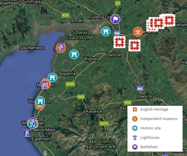
A register of the known and presumed locations of wrecks (illustrated by crosses) and losses (illustrated with circles) is maintained by Historic Environment Scotland – illustrated in the map opposite.

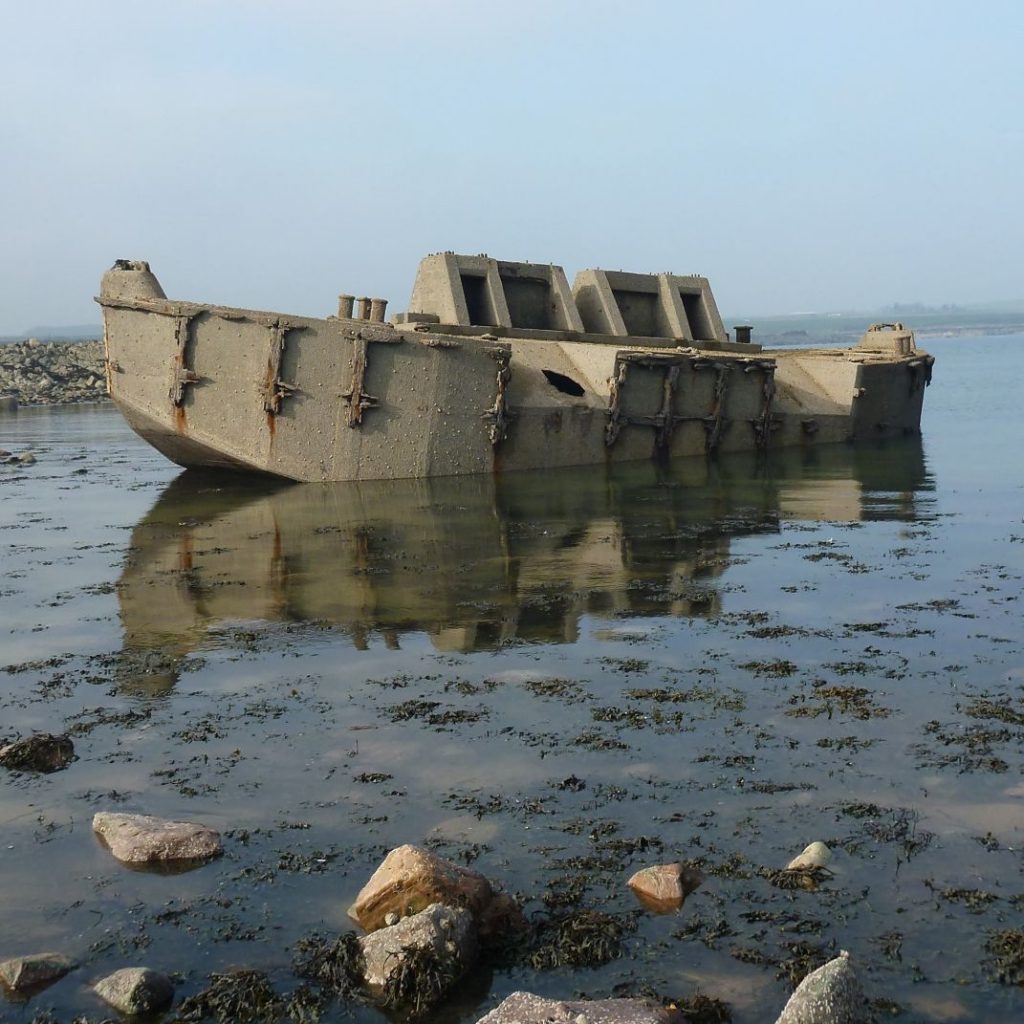
The protected wrecks (red crosses) are located near the village of Garlieston and each indicates the remains of prototype Mulberry Harbours. These were temporary portable harbours that were tested on the Solway prior to their use in the Allied invasion of Normandy in 1944, during World War II. The role the area played in developing and testing the pioneering structures, vital to the success of the D-Day landings, continues to act as an attraction (BBC News Scotland, 2019).

Previous defence activity in and around the Solway contributes to the cultural heritage and draws visitors to the area through tourism. Garlieston has had exhibitions and books focussed on this point in Garlieston’s history, and even holds a military themed weekend calledGarlieston’s Military Weekend each year with a vintage 1940’s theme to celebrate and remember the historic connection Garlieston had to World War II.


Coastal Historic Properties and Sites

The Galloway coastline is dotted with sites of historical significance, including castles, churches, and other sites such as standing stones and cairns, as well as a number of museums and heritage attractions. Many of these are managed by Historic Environment Scotland, of which the most prominent is Caerlaverock Castle (pictured on the following page), located south of Dumfries. The castle received 35,305 visitors in 2018, down -8% on the previous year.

There is also a network of Dumfries & Galloway Council-operated local heritage museums, with free entry, spread around the Solway coast, with locations in:

  • Stranraer, with 10,580 visitors in 2017;
  • Wigtown, with 8,310 visitors in 2017;
  • Kirkcudbright, with 12,245 visitors in 2017; and
  • Annan (no data available).

The coastal setting of each town means that the marine environment has played an important role in their culture, economy and society through the centuries, and this is reflected in each museum’s collection and interpretation.

Scottish Solway- Historic Sites and Museums Map

Scottish Solway- Historic Sites and Museums. (Source: Online searches. Map Data © Google Maps)


There are ten lighthouses on the Scottish Solway coast, although not all of them are still maintained by the Northern Lighthouse Board.

The Scottish Solway Lighthouses are (from east to west);

  • Southerness
  • Hestan Island
  • Little Ross
  • Mull of Galloway
  • Crammag Head
  • Port Logan
  • Portpatrick
  • Killantringan
  • Corsewall Point
  • Loch Ryan

The Mull of Galloway lighthouse is part of the Scotland’s Outstanding Lighthouses tourism initiative. It includes a visitor centre and coffee shop, open seasonally and operated by the Mull of Galloway Trust, a community landowner. It received 9,812 visitors in 2017. The three lighthouse cottages are also available for let by visitors.

Southerness lighthouse was decommissioned in 1931 and is under private ownership – the building is Category A listed but due to its poor condition, is included on the Buildings At Risk Register.

Of the independent heritage museums around the Scottish Solway coast, the John Paul Jones Cottage Museum and Visitor Centre, located near Southerness, has a specific marine focus. The museum is the birthplace of John Paul Jones (1747-1792), who was a commander in the American Revolutionary War and considered to be the ‘father of the American Navy’.

The Solway Military Trail was launched in 2019 to increase awareness of the area’s military history and promote it as an attraction for visitors. Funding and support was provided by Visit Allerdale, Foundation Scotland and Solway Firth Partnership. The four trail routes take in both sides of the Solway Firth, with attractions on the Scottish side including the Devil’s Porridge Museum at Eastriggs, the Dumfries & Galloway Aviation Museum at the former RAF Dumfries, and remains of a WWII bombing target on Sandyhills beach.

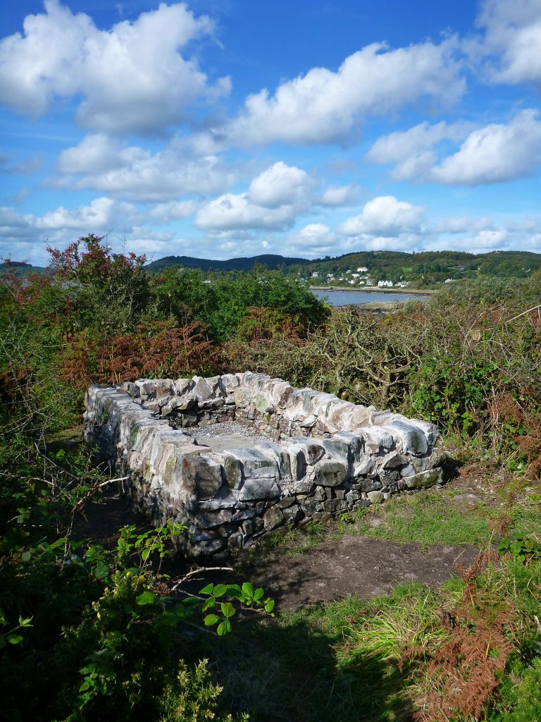
Much of the physical evidence of WWII history around Loch Ryan has been dismantled and dispersed. However there are a few publicly accessible sites that still show structures from that period such as the lookout post and flying boat slip ways at the Wig. The Loch Ryan WWII leaflet below provides more information of sites to visit.

The Galloway Glens Landscape Partnership Scheme is a multi-million National Lottery Heritage Fund supported initiative that is aiming to undertake a series of projects across the area to ‘connect people, communities and their heritage’ around the River Ken and River Dee, from the source to the sea, and includes the towns of Kirkcudbright and Castle Douglas. Having secured funding for five years, it will run until around 2022. The scheme is running a range of natural and historic environment focused projects, around skills and education, conservation, access, and developing the visitor economy.


Listed Buildings and Scheduled Monuments

Hundreds of listed buildings are spread along the coastline of the Solway Firth Region. Listed status is awarded to buildings with special historical or architectural interest, and in Scotland is administered by Historic Environment Scotland. While not all of these buildings and monuments will have a strong connection with the maritime past, many do.

Scheduled monuments are also spread throughout the region, a designation reserved for archaeological sites and monuments deemed to be of national importance. These are often defensive installations or religious sites, and can date from prehistoric times to as recently as the Second World War.

Prominent ‘A’ listed buildings on or near the Scottish Solway include Caerlaverock Castle, Logan House, and Portpatrick Old Parish Church, as well as the Corsewall, Southerness and Mull of Galloway lighthouses.

Scottish Solway - Listed Buildings Map

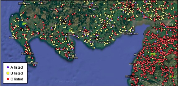
Scottish Solway- Listed Buildings (Source: British Listed Buildings (n.d.) please note the interactive map on this website has since been shut down. Map Data © Google Maps)


Funding

A variety of funding mechanisms are available to support the preservation of coastal historic environment and cultural heritage. This includes the UK Government’s Coastal Communities Fund, which aims to stimulate economic development in coastal towns, and the National Lottery Heritage Fund which provides grant funding to support a wide range of heritage projects.

Coastal Heritage at Risk

The Scotland’s Coastal Heritage at Risk project is run by the SCAPE Trust, a charity based at the University of St Andrews. Between 2012 and 2016, the project set out to map coastal heritage sites around Scotland that are threatened by erosion – the key sites within the Scottish Solway are shown in the map below.

Sites were recorded by volunteers and then assessed against different criteria (including their vulnerability, intrinsic value, and community value) and assigned a priority rank. The project has also involved community initiatives at locally-valued threatened sites – including two on the Scottish Solway. Both projects involved working with local young people to produce videos focused on local coastal heritage. Much of this is about recognising that a process of loss is inevitable, and taking steps to record information while it is available. Using this as an opportunity to engage communities in the process can then increase awareness and understanding of coastal heritage and archaeology.

Scottish Solway- Coastal Heritage Sites at Risk

Scottish Solway- Coastal Heritage Sites at Risk (Source: SCHARP Sites At Risk Map (Scotland’s Coastal Heritage at Risk, n.d.). Map Data © Google Maps) 

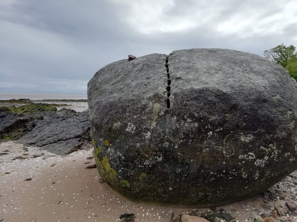
Some of the sites ranked as high priority include a pre-Medieval fort near Isle of Whithorn, the Mulberry Harbour remains at Garlieston, two shipwrecks near Kirkcudbright, a Victorian inter-tidal lido at Powfoot, and a possible 13-15th century kiln at Redkirk Point.


Image; Scotland’s National Marine Plan Interactive, with layers (links will provide usage licence, data provider, etc); ‘Solway Region (mask)‘ © Crown Copyright, All rights reserved, ‘Wrecks (HES) – November 2018‘ © Crown Copyright, All rights reserved, ‘Losses (HES) – November 2018‘ © Crown Copyright, All rights reserved.

Historic environment and cultural heritage

Scotland -Pressures and Impacts

An assessment of the socio-economic and environmental pressures and impacts of the historic environment and cultural heritage sector is provided below.

Socio-Economic
Positive Negative
•   Contributes to the tourism offer in the south west of Scotland – attracting significant visitors annually (both national and international)

•   Safeguarding and promoting the cultural and heritage offering helps to define the ‘sense of place’ of the Scottish Solway

•   The marine environment also offers an educational asset for the region, and features prominently in museums and heritage interpretation across the region

•   Potential restriction of new development and conflicts with commercial activity
Environmental
Pressure theme Pressure Impact
Pollution and chemical Introduction of hazardous substances


There is the potential of pollution e.g. fuel, oil and other chemical leakages from historic maritime wrecks and metal corrosion over time. This came to the fore when parts of the Beaufort’s Dyke munitions disposal site were disturbed by pipeline laying works in the 1990s.
Other physical Litter The growth in tourism and the number of people visiting heritage and cultural sites/attractions could lead to an increase in littering. Not only does this impact on the visual amenity, there is a risk to both marine wildlife, for example entanglement or smothering, and to people using the water for recreation.
Habitat change Habitat damage There is a risk that visitors to heritage and cultural attractions can damage or disturb surrounding habitats, for example, those visiting maritime wrecks could damage the site or seabed.

There is also a risk of visitors removing flora or fauna from the natural environment.


Image; Nelson’s Grave. © N. Coombey/ Solway Firth Partnership.

Historic environment and cultural heritage

Scotland - Regional Look Forward

The historic environment is one of Scotland’s key draws for visitors, particularly for those from overseas, and the Scottish Solway coast has much to offer in this regard. With efforts ongoing to increase the standing of the south of Scotland as a visitor destination, the historic environment will continue to feature prominently in this activity.

Much of the historic environment sector activity is focused on increasing understanding and engagement among local residents, including through work with schools and community groups. Notable examples include the SCAPE Trust’s Scottish Coastal Heritage at Risk project and the Galloway Glens Landscape Partnership Scheme.

The historic environment of the region will face a number of naturally occurring and man-made threats over the coming years, notably coastal erosion. Access to funding also remains a key issue when it comes to preserving the historic environment.


Image; Knockbrex, Bathing House, Category B listed building. © Solway Firth Partnership

Historic environment and cultural heritage

England - Summary

Much of the cultural heritage and built environment has been shaped by the Solway in one way or another – coastal towns and villages have relied on the fishing sector and its supply chain for employment. Its position as a border region means that there has been a long history of cross-border raids and battles, from Hadrian’s Wall to the Border Reivers in the Middle Ages.

As noted in Shipping and Transport, the main towns along the English Solway Coast developed as ports, primarily to serve the region’s industrial base. It therefore has an intrinsic link with the maritime environment and heritage, and evidence of this includes: maritime wrecks, historic buildings and sites, maritime and heritage museums, and industrial heritage including docks, mines and bridges.

The historical and cultural assets in the region also make a notable contribution to the region’s visitor and tourism provision, and provide an educational resource and contribute to the sense of place. The preservation of these assets helps to foster the emotional and cultural identity of the Solway as a distinct area.

In addition, the sector provides employment opportunities for those within the operational side, and the conservation and preservation of sites, buildings and monuments.

Given the diverse nature of the historic environment and cultural heritage sector it has not been possible to gather data on the economic activity and value it supports. Much of this will be captured in the sport, recreation and tourism figures. That being said, where data is available we have identified visitor numbers and visitor expenditure for heritage/cultural sites and attractions.


Image; Maryport Lighthouse. © Solway Firth Partnership

Historic environment and cultural heritage

England - Contribution to the economy

The economic contribution of the sector is not accurately captured through official data sources. This is made especially difficult given the supported jobs indirectly helped through a flourishing heritage sector. The majority of activity is driven by visits to historic sites and attractions and is therefore captured and reported below.

However, in order to provide some context for the important role that heritage and the historic environment plays within England’s wider tourism offering, research has shown:

  • around one-third (34%) of domestic tourists cite being able to visit a historic building or monument as their ‘sole reason’ or a ‘very important reason’ why they took a domestic holiday or short break. This increases to 63% for day visitors (Historic England, 2019a);
  • almost three-quarters of adults (72.8%) in England, or approximately 40 million people, visited a heritage site at least once in 2017/18 (Historic England, 2019a); and
  • the total tourism spend of heritage-related visits and trips in England in 2018 has been estimated at £17bn, from 218.4m visits (Historic England, 2019a).
  • In the north west, there were 25.4m visits with spend of £1.62bn (Historic England, 2019b).
    • The majority of these visitors were classified as domestic day trips with 22 million visitors spending £520 million. Domestic overnight trips make up 2 million visitors and a total spend of £466 million and then international trips with 1.4 million visitors and a total spend of £637 million (Historic England, 2019b).


Historic environment and cultural heritage

England - Historic Environment and Cultural Heritage Activity


Maritime Wrecks

The long history of seafaring in the Solway Firth means that it is, inevitably, the location of a large number of maritime wrecks and losses.

A register of the known and presumed locations of wrecks and losses is maintained by Historic England – illustrated in the map below ‘English Solway- Located Remains of Maritime Wrecks and Losses’. There are no protected wrecks in the North West Marine Plan Area (shaded in red). Losses are shown in the map opposite as grey circles.


Coastal Historic Properties and Sites

The Cumbrian coastline is dotted with sites of historical significance, including castles, churches, monuments, as well as a number of museums and heritage attractions, see map below, ‘English Solway- Historic Sites and Museums’. Sitting at the frontier of the Roman Empire and the site of frequent conflict between Scotland and England over the centuries, there are a number of fortifications and ruins, including parts of Hadrian’s Wall, a UNESCO World Heritage Site.

The marine environment has played an important historic role in the culture, economy and society of Cumbria’s coastal communities. This is reflected in the content of local history museums in Silloth, Maryport, Workington and Whitehaven.

Museum

Location

Description

Cumbria’s Museum of Military Life

Carlisle

Tells the 300-year story of Cumbria’s County Infantry Regiment and its soldiers past and present.

Solway Coast Discovery Centre

Silloth

Exhibition on history of the Solway Coast from the last ice age to the present day

Senhouse Roman Museum

Maryport

Situated next to 1st century Roman fort at Maryport, from where many of its display objects are derived

Maryport Maritime Museum

Maryport

In a former pub, houses objects, photographs and paintings relating to the maritime, industrial and social history of Maryport

Helena Thompson Museum

Workington

Exhibits and collections relating to the town’s history, named after a local philanthropist

Beacon Museum

Whitehaven

Museum of Copeland’s history, including the history of Whitehaven’s harbour

The Rum Story

Whitehaven

Opened in 2000, telling the story of the rum trade in Whitehaven, housed in a warehouse dating from 1785

English Solway - Historic Sites and Museums Map

English Solway- Historic Sites and Museums (Source: Online searches. Map Data © Google Maps)

There are seven lighthouses on the English Solway (the above map appears to show four, as three are in close proximity in Whitehaven and two in Maryport).

The Cumbrian Lighthouses on the Solway coast are;

  • Silloth East Cote
  • Maryport South Pier
  • Maryport old
  • Whitehaven North Pier
  • Whitehaven Harbour
  • Whitehaven Old New Quay
  • St Bees Head

St Bee’s Lighthouse, built in 1822, is operated by Trinity House, the official authority for lighthouses in England. It was automated in 1987. An adjacent Fog Horn Station is owned by the National Trust – in 2016, it was opened to the public over one weekend (National Trust, n.d.)

The historic lighthouse at Maryport harbour is no longer in use, having been replaced by a new aluminium tower in 1996. The original lighthouse, dating from 1846, was restored in 2017 with £50,000 from the UK Government Coastal Communities Fund (ITV News, 2017).

There are three lighthouses at Whitehaven harbour, dating from 1742, 1839 and 1841 but all are now disused. Work is ongoing to restore the two 19thcentury lighthouses, with £40,000 from the UK Government Coastal Revival Fund. It is hoped that this will tie in with learning projects with the local community, enabling a much greater understanding of the role that lighthouses have played in the town’s history (Times & Star, 2019).

Silloth East Cote lighthouse was originally built in 1864. It was rebuilt in its original style in 1997 by the operator of the Port of Silloth, Associated British Ports.

The Solway Military Trail was launched in 2019 to increase awareness of the area’s military history and promote it as an attraction for visitors via a website. Funding and support was provided by Visit Allerdale, Foundation Scotland and Solway Firth Partnership. The four trail routes take in both sides of the Solway Firth, with attractions on the English side including the Solway Coast Discovery Centre and Solway Aviation Museum, and the large number of former RAF sites in the area.

The area’s military history does, however, stretch back much further – as well as being the frontier of the Roman Empire, the border region was strongly contested during medieval times and the site of frequent skirmishes and raids between England and Scotland.

Hadrian’s Wall – among the most important monuments to the Roman presence in Britain – begins at Bowness-on-Solway, on the Solway coast. It marked the frontiers of the Roman Empire and its construction began in the year 122 AD, in the reign of the Emperor Hadrian. A National Trail footpath runs for 84 miles from coast to coast, following the route of the wall.

Carlisle Castle, with a keep dating from the 1100s, is run by English Heritage and open to the public. In 2018, it received over 177,000 visitors, a significant uplift (+285.4%) on previous years (Association of Leading Visitor Attractions, n.d). This rise can be attributed to a temporary remembrance poppy sculpture displayed at the castle in the summer of 2018 (ITV News, 2018).

There is one registered battlefield in the region, the site of the Battle of Solway Moss in 1542. This saw between 10-17,000 Scottish soldiers invade England, following Henry VIII’s split from the Catholic Church, where they suffered a defeat at the hands of the comparably small 3,000 strong English troops (Historic England, 1995).

A memorial to King Edward I of England was erected in 1685 at Burgh by Sands on the Solway Plain, marking the spot where the king died in 1307 while camping with his army during a long-running campaign against his adversary, King Robert I of Scotland. The monument was rebuilt in 1803, and repaired in 1876 and 2000, and is Grade II* listed.


Listed Buildings and Scheduled Monuments

Hundreds of listed buildings are spread along the coastline of the English Solway, see Map below ‘English Solway- listed buildings’. Listed status is awarded to buildings with special historical or architectural interest, and in England is administered by Historic England. While not applicable to all, many of these buildings and monuments have a strong connection with the maritime past.

Prominent Grade I listed buildings close to the English Solway coast include Drumburgh Castle, Workington Hall, and various elements of the Priory Church in St Bees.

Scheduled monuments are also spread throughout the region, a designation reserved for archaeological sites and monuments deemed to be of national importance. These are often defensive installations or religious sites, and can date from prehistoric times to as recently as the Second World War.

English Solway - Listed Buildings

English Solway- listed buildings (Source: Source: British Listed Buildings (n.d.) website map has since been shut down. Map Data © Google Maps)


Funding

A variety of funding mechanisms are available to support the preservation of coastal historic environment and cultural heritage. This includes the UK Government Coastal Communities Fund and Coastal Revival Fund which aim to stimulate economic development in coastal towns. The National Lottery Heritage Fund also provides grant funding to support a wide range of heritage projects.


Image; Scotland’s National Marine Plan Interactive, with layers (links will provide usage licence, data provider, etc); ‘Solway Region (mask)‘ © Crown Copyright, All rights reserved, ‘Wrecks (HES) – November 2018‘ © Crown Copyright, All rights reserved, ‘Losses (HES) – November 2018‘ © Crown Copyright, All rights reserved, ‘Limits and Boundaries – NE and NW Marine Plan Areas for England (MMO) – August 2016‘ © Crown Copyright, All rights reserved

Historic environment and cultural heritage

England - Pressures and Impacts

An assessment of the socio-economic and environmental pressures and impacts of the Historic Environment and Cultural Heritage sector is provided below.

Socio-Economic
Positive Negative
•   Contributes to the region’s tourism offering – attracting significant visitors annually (both national and international), including Hadrian’s Wall, a UNESCO World Heritage Site

•   The historic and heritage environment also offers an educational asset for the region

•   Safeguarding and promoting the cultural and heritage offering helps to define the region’s ‘sense of place’

•   There is a broad network of historical/archaeological/heritage societies that help promote the region, educate, and deliver volunteering and training opportunities

•   Potential conflict of uses with other sectors e.g. restricted activity near sites with conservation status e.g. fishing or recreation activities

•   Potential restriction of new development

Environmental
Pressure theme Pressure Impact
Pollution and chemical Introduction of hazardous substances


There is the potential of pollution e.g. fuel, oil and other chemical leakages from historic maritime wrecks and metal corrosion over time.
Other physical Litter The growth in tourism and the number of people visiting heritage and cultural sites/attractions could lead to an increase in littering. Not only does this impact on the visual amenity, there is a risk to both marine wildlife, e.g. entanglement or smothering, and to people using the water for recreation.
Habitat change Habitat damage There is a risk that visitors to heritage and cultural attractions can damage or disturb surrounding habitats, for example, those visiting maritime wrecks could damage the site or seabed.

There is also a risk of visitors removing flora or fauna from the natural environment.


Historic environment and cultural heritage

England - Regional Look Forward

The historic environment is one of England’s key draws for visitors, particularly overseas visitors. Although the main Hadrian’s Wall sites and visitor centres are more inland, the route of the wall does run to the Solway Coast and will help attract visitors to the area. Maryport also has the Senhouse Roman Museum and remains of a fort.

Much of the historic interpretation along the English Solway Coast focuses on more recent history and, in this respect, has a strong coastal element.

The region’s historic environment will face a number of naturally occurring and man-made threats over the coming years, most notably coastal erosion. Access to funding will remain a key issue when it comes to preserving the historic environment.


Image; Maryport Harbour. © Solway Firth Partnership

Historic environment and cultural heritage

References

Baxter, J.M., Boyd, I.L., Cox, M., Donald, A.E., Malcolm, S.J., Miles, H., Miller, B., Moffat, C.F., (Editors), (2011). Scotland’s Marine Atlas: Information for the national marine plan. Marine Scotland, Edinburgh. pp 191. Available here. (Accessed 22.07.19)

Historic England (n.d.). Visit a Protected Wreck Site. Available here. (Accessed: 01.09.20)

Marine Management Organisation. (n.d). Marine Planning Evidence Base. Available here. (Accessed: 14.05.18)

Marine Scotland (n.d.). Scotland’s National Marine Plan Interactive. Available here. (Accessed: 06.08.19)

Mills, F., Sheridan, S. and Brown S., (2017). Clyde Marine Region Assessment. Clyde Marine Planning Partnership. pp 231, Available here. (Accessed: 14.05.18)

Office for National Statistics (Various) Annual Business Survey (ABS): custom data request from the ONS & Public data. Available here. (Accessed: 28.07.20)

Office for National Statistics (Various) Business Register and Employment Survey (BRES). Available here. (Accessed: 28.07.20)

Scottish Government (2019) Scottish Annual Business Statistics 2017 (SABS). Available here. (Accessed: 28.07.20)

VisitScotland (2016) Scotland Visitor Survey 2015 & 2016, Regional Results Dumfries and Galloway. Available here. (Accessed: 01.09.20)

VisitScotland Documents provided to EKOS.


In-Text References;

Association of Leading Visitor Attractions (n.d) 2018 Visitor Figures. Available here. (Accessed: 01.09.20)

BBC News Scotland (2019). Scotland’s role in the D-Day landings. Available here. (Accessed: 23.07.20)

BBC News (2014). Annan to Bowness-on-Solway rowing raid recreated. Available here. (Accessed: 03.11.20)

British Listed Buildings (n.d.). Listed Buildings online map. Previously Available here (link included in the hopes of map replacement in the future). (Accessed: 28.04.20)

English Heritage (1995). Historic England, Battlefield Report: Solway Moss 1542. Available here. (Accessed: 23.07.20)

Historic England (2019a). Heritage and the Economy 2019. Available here. (Accessed: 23.07.20)

Historic England (2019b). Heritage and the Economy 2019 – North West. Available here. (Accessed: 23.07.20)

Historic Environment Scotland (2018). Scotland’s Historic Environment Audit 2018. Available here. (Accessed: 23.07.20)

ITV News (2018). 5,500 poppies cascade down Carlisle Castle. Available here. (Accessed: 23.07.20)

ITV News (2017) Maryport Lighthouse restoration unveiled. Available here. (Accessed: 23.07.20)

National Trust (n.d.) Discover St Bees Fog Horn Station. Available here. (Accessed: 23.07.20)

Scottish Government (2019). Scottish Household Survey 2018. Available here. (Accessed: 23.07.20)

Scotland’s Coastal Heritage at Risk (n.d.) Sites at Risk map. Available here. (Accessed: 28.08.20)

Times & Star (2019) Lighthouse work goes on behind the scenes. Available here. (Accessed: 23.07.20)

Visit Scotland (2017). Scotland Visitor Survey 2015 and 2016. Available here. (Accessed: 23.07.20)

Scottish Coastal Heritage at Risk (n.d.) Sites At Risk Map. Available here. (Accessed: 28.08.20)


Image; Killantringan Lighthouse in the mist. © N. Coombey/ Solway Firth Partnership.