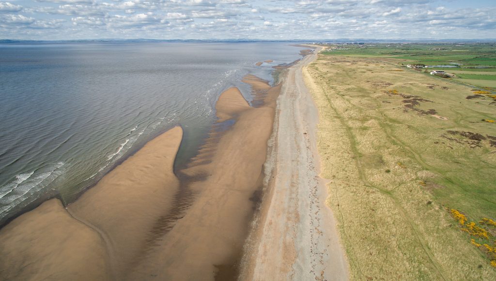
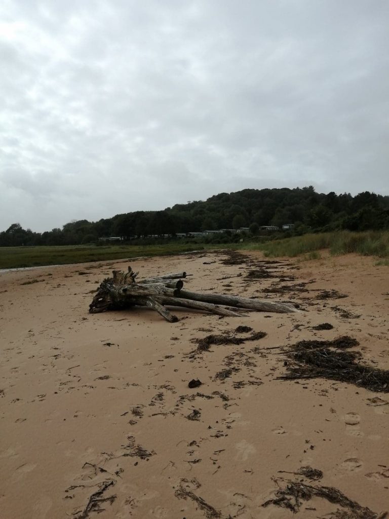
Intertidal rock, sediments and biodiversity
References
Cumbria Biodiversity Data Centre. (n.d.) Available here. (Accessed: 10.03.18)
Cumbria Biodiversity Data Centre (2016). Habitat statement – Coastal Intertidal Habitats. Available here. (Accessed: 01.04.21)
Cumbria Biodiversity Partnership (2001). The Cumbria Biodiversity Action Plan. Available here. (Accessed: 01.04.21)
Joint Nature Conservation Committee and Department of Environment, Food and Rural Affairs (on behalf of the Four Countries’ Biodiversity Group). (2012). UK Post-2010 Biodiversity Framework. Available here. (Accessed: 07.07.18)
Joint Nature Conservation Committee (2007). UK Biodiversity Action Plan Priority Marine Species. Available here. (Accessed: 07.03.18)
Joint Nature Conservation Committee (2007). UK Biodiversity Action Plan Priority Habitats. Available here. (Accessed: 07.03.18)
Marine Life Information Network (n.d.). Habitats listed as Features of Conservation Interest (FOCI). Available here. (Accessed: 14.05.20)
Marine Life Information Network (n.d.). Habitats listed as ‘habitats of principal importance’. Available here. (Accessed: 14.05.20)
Marine Management Organisation. (n.d). Marine Planning Evidence Base. Available here. (Accessed: 14.05.18)
Marine Scotland (n.d.). National Marine Plan Interactive. Available here. (Accessed: 06.08.19)
Michael T. Burrows, Nova Mieszkowska, John Baxter, Cristina Vina-Herbon, Gemma Singleton, Karen Robison & Mike Young (2018). Intertidal community index (MarClim). UK Marine Online Assessment Tool. Available here. (Accessed: 05.04.21)
Mills, F., Sheridan, S. and Brown S., (2017). Clyde Marine Region Assessment. Clyde Marine Planning Partnership. pp 231. Available here. (Accessed: 14.05.18)
NatureScot (2020). Priority Marine Features in Scotland’s Seas. Available here. (Accessed: 01.04.21)
NatureScot (2020). Scottish Biodiversity List. Available here. (Accessed: 04.05.21)
Phillips, G., McGruer, K., Crook, D., Doria, L., Herbon, C., Khan, J., Mackie, T., Singleton, G. & Young, C. (2018). Condition of intertidal rocky shore macroalgae (seaweed) communities in coastal waters determined using Water Framework Directive methods. UK Marine Online Assessment Tool. Available here. (Accessed: 05.04.21)
Phillips, G., McGruer, K., Crook, D., Doria, L., Herbon, C., Khan, J., Mackie, T., Singleton, G. & Young, C. (2018). Condition of intertidal saltmarsh communities in coastal waters determined using Water Framework Directive methods. Marine Online Assessment Tool. Available here. (Accessed: 05.04.21)
Phillips, G., McGruer, K., Crook, D., Doria, L., Herbon, C., Khan, J., Mackie, T., Singleton, G. & Young, C. (2018). Condition of intertidal seagrass communities in coastal waters determined using Water Framework Directive methods. UK Marine Online Assessment Tool. Available here. (Accessed: 05.04.21)
Solway Firth Partnership (1996). The Solway Firth Review, Solway Firth Partnership, Dumfries. Available here. (Accessed 23.07.19)
UK National Ecosystem Assessment (2011). The UK National Ecosystem Assessment Technical Report. UNEP-WCMC, Cambridge. Available here. (Accessed: 28.05.18)
In-Text References;
Baxter, J.M., Boyd, I.L., Cox, M., Donald, A.E., Malcolm, S.J., Miles, H., Miller, B., Moffat, C.F., (Editors), (2011). Scotland’s Marine Atlas: Information for the national marine plan. Marine Scotland, Edinburgh. pp 191. Available here. (Accessed: 22.07.19)
Burden, A., Smeaton, C., Angus, S., Garbutt, A., Jones, L., Lewis H.D.and Rees. S.M. (2020). Impacts of climate change on coastal habitats relevant to the coastal and marine environment around the UK. MCCIP Science Review 2020, 228–255. Available here. (Accessed: 01.04.21)
C-SIDE (n.d.) The C-SIDE Project. Available here. (Accessed: 22.07.20)
Cutts, N. & Hemmingway, K. (1996). The Solway Firth: broad scale habitat mapping. Scottish Natural Heritage Research, Survey and Monitoring Report No. 46. Available here. (Accessed: 22.07.20)
Department for Environment, Food & Rural Affairs (2019). Marine Strategy Part One: UK updated assessment and Good Environmental Status. Available here. (Accessed: 22.07.20)
Dumfries and Galloway Biodiversity Partnership (2009). Dumfries and Galloway Local Biodiversity Action Plan. Available here. (Accessed: 01.04.21)
Foster and Davidson (2018). Angiosperm Monitoring for the EU Water Framework Directive 2013 – 2015: Baseline seagrass surveys of the Montrose Basin, Eden Estuary, Forth Estuary and Loch Ryan. Report Number: MB-01/2018. Available here. (Accessed: 01.04.21)
Haynes, T.A. (2016). Scottish saltmarsh survey national report. Scottish Natural Heritage (now NatureScot). Commissioned Report No. 786. Available here. (Accessed: 22.07.20)
Historic England (n.d.). Intertidal and Coastal Peat Database, Cumbria. Available here. (Accessed: 28.04.21)
HR Wallingford Limited (2005). Dumfries and Galloway Shoreline Management Plan, Study: Stage 1, Volume 1, Report EX 4963 Rev 2.0. Available here. (Accessed 22.07.19)
Marine Scotland Science (2015). Solway Cockle Fishery Management Study. Available here. (Accessed: 28.07.20)
McKay, D.W. and Fowler, S.L. (1997). Review of the Exploitation of the Mussel, Mytilus edulis, in Scotland. Scottish Natural Heritage (now NatureScot) Review. No 68. Available here. (Accessed: 28.07.20)
Scottish Coastal Archaeology and the Problem of Erosion (SCAPE) (2019). Mesolithic oaks to Mulberry Harbours – 8,000 years of history along the Solway Firth. Available here. (Accessed 27.04.21)
United Kingdom Marine Monitoring & Assessment Strategy (n.d.). Summary of Progress towards Good Environmental Status. Available here. (Accessed: 15.12.20)
Image; Rayed trough shell. © N. Coombey/ Solway Firth Partnership