Transitional and coastal waters

Status: Purely descriptive 
 
The European Union (EU) Water Framework Directive (WFD) (2000/60/EC) provides a legal framework and common goal for the protection, improvement and sustainable use of 5 waterbody types on a catchment scale. These waterbodies are classed as; rivers, lochs/lakes, groundwater, transitional and coastal waters. The competent monitoring authority must ensure that the waterbodies reach at least ‘Good’ qualitative or quantitative status. The WFD is also concerned with the protection of water quality and valuable habitats, drinking waters, and bathing waters.

The WFD is closely linked to the Marine Strategy Framework Directive (MSFD) which drives member states to reach Good Environmental Status (GEnvS) in the marine environment. There is an overlap between these two directives within the coastal extent of the WFD.

In Scotland the work to implement the Directive is the responsibility of the Scottish Environment Protection Agency (SEPA) and in England it is the responsibility of the Environment Agency (EA).


Image; Walkers on the coast © Solway Firth Partnership. Photographer; K. Kirk

Transitional and coastal waters

How is the WFD implemented?

The Water Framework Directive (WFD) was transposed into national law in England and Wales law through the following regulations: The Water Environment (Water Framework Directive) (England and Wales) Regulations 2003 (Statutory Instrument 2003 No. 3242). In Scotland this happened through the The Water Environment and Water Services (Scotland) Act 2003 (as amended) (WEWS Act) and Water Environment (Controlled Activities) (Scotland) Regulations 2011 (CAR) (as amended). These two Scottish acts form a framework for authorisation of activities which may interfere with the water environment.

The Environment Agency (EA) is the lead national authority in England responsible for implementing the 2003 Regulations, in partnership with other responsible organisations such as; Natural England, Forestry Commission, Canal and River Trust, water companies (United Utilities is the water company on the English side of the Solway), and Local Authorities.

The Scottish Environment Protection Agency (SEPA) is responsible for the enforcement of CAR. SEPA is also the lead national authority responsible for implementing the WEWS Act working in partnership with responsible authorities in planning and implementation of river basin plans such as; NatureScot (NS), Scottish Water, Forestry and Land Scotland, Scottish Canals, Local Authorities, District Salmon Fisheries Boards. The designated functions of these responsible authorities are outlined in the Water Environment (Relevant Enactments and Designation of Responsible Authorities and Functions) (Scotland) Order 2011.

A table of the requirements the WFD requires is provided in Appendix 3 of the 2015 SEPA update to the Solway Tweed river basin management plan. The appendices are available here.


Image; Port Carlisle © Solway Firth Partnership

Transitional and coastal waters

What area does it cover?

WFD’s full protection for both ecology and water quality extends to all freshwater bodies and ‘coastal’ waters. Within the Solway Firth there are a combination of coastal and transitional waterbodies. There are also rivers which run into the Firth, however only coastal and transitional waters will be discussed given that rivers are freshwater.

‘Coastal’ waters are defined as waters out to 1 nautical mile (nm) in England, and 3nm in Scotland from baselines. Baselines are the line where a country begins measurements out into the marine environment for jurisdictional claims under the United Nations Convention on the Law of the Sea. Baselines are most often considered as the low water mark along the coast, however deviations are permitted for a variety of reasons, for example to draw a line across bays, and around islands in certain circumstances. In the UK baselines are determined by the Territorial Sea (Baseline) Order 2014, and a data layer is available on the National Marine Plan Interactive to display the baseline around Scotland. In terms of the Solway, the baseline is drawn across the mouth of the Solway from Ross in Kirkcudbright to St Bees Head in Cumbria, and over the Cree estuary and Luce Bay. A straight baseline is also drawn between ~South Cairn and the Mull of Kintyre

‘Transitional’ waters are where water is partially saline at river mouths. This is where salty marine water is being introduced into freshwaters, transitioning water bodies from freshwater to marine.

The distance extends to 12nm into the marine environment for water chemistry. Under the WFD, water bodies will be managed as integrated River Basin districts, from source to sea.


Image; Grune Point © Solway Coast Area of Outstanding Natural Beauty

Transitional and coastal waters

River Basin Management

River basin management plans (RBMPs) create a single system of water management on a river basin level which allows for coherent planning regardless of administrative boundaries. River Basin Districts are a natural geographical and hydrological unit and non-conforming to administrative boundaries. RBMPs are updated on a 6 yearly basis, and are required by the WFD. Objectives are set in RBMPs for the river basin (the level of ecological, chemical, quantitive or protected area status being aimed for), and how they will be achieved. SEPA creates RBMPs in Scotland and the EA does so in England.

In Scotland there are 2 river RBMPs covering the Solway Tweed river basin and the Scotland river basin. England is covered by 7 RBMPs, the North West RBMP covers the English side of the Solway west from roughly Dubmill Point.

The Solway Tweed river basin district is managed jointly between SEPA and the EA because it is a cross border river basin (The Water Environment (Water Framework Directive) (Solway Tweed River Basin District) Regulations 2004).

RBMPs include water bodies current state, legally binding objectives for waterbodies, and condition and objectives for protected areas (including wildlife conservation areas, shellfish water and bathing waters).

According to the European Commission website, the RBMP is; “a detailed account of how the objectives set for the river basin (ecological status, quantitative status, chemical status and protected area objectives) are to be reached within the timescale required. The plan will include… the river basin’s characteristics, a review of the impact of human activity on the status of waters in the basin, estimation of the effect of existing legislation and the remaining “gap” to meeting these objectives; and a set of measures designed to fill the gap.” (European Commission, n.d.)

SEPA works with responsible authorities (eg Scottish Water, NatureScot), the National Advisory Group, the Diffuse Pollution Management Advisory Group, the Fish and Fisheries Advisory Group, and Area Advisory Groups (AAGs). Within the Solway Tweed River Basin there are two AAGs, one for the Tweed and one for the Solway. The multi-stakeholder AAG helps inform the RBMP planning process and provides a platform for disseminating information on the river basin management process, helps identify opportunities for joint working, and identifies new partners which could help in the delivery of RBMP objectives. The Solway AAG developed the Solway area management plan during the first cycle of basin planning and there was also a draft South Solway Area Management Plan (2010-2015). These documents are available here.

RBMPs in both Scotland and England will be reviewed in 2021 in line with the WFD.


Image; People on the coast at Powillimount © G.Reid/ Solway Firth Partnership

Transitional and coastal waters

Classification of water body status

The status/quality of a water body is classified in accordance with Annex V off the Water Framework Directive (WFD) which lists elements for the classification of; rivers, lakes, transitional waters, coastal waters, and artificial/heavily modified water bodies.

‘Good Status’ means Good Overall Waterbody Status, which requires reaching a minimum ‘good’ status for ecological and chemical status for surface water bodies (rivers, lochs/lakes, transitional and coastal waters), or ‘good’ quantitative and chemical status for groundwater water bodies.

The assessment of ecological and chemical status is measured on a 5 status scale; high, good, moderate, poor, bad. Many biological, physical and chemical parameters (or qualitative elements) of a waterbody can be measured and classed and contribute to the overall ecological status of a water body. The parameters fit into four categories; biological, hydromorphological and physio-chemical quality elements, in addition to specific pollutants. Overall classifications for ecological and chemical status are decided and based on the elements with the lowest assessed class.

There is an aim for water bodies to achieve ‘Good Ecological Status’ (GEcS) or ‘Good Ecological Potential’ (GEcP) depending on the origins of the waterbody. Unnatural waterbodies such as, man-made canals, reservoirs etc, or waterbodies which have undergone extensive modifications such as for, flood mitigation, drainage, storage, safety, navigation, etc, seek to achieve GEcP. There are no ‘artificial‘ water bodies in the Scottish Solway Firth, but the ‘Nith Estuary’, ‘River Dee (Loch Ken Outlet to Tongland)’, ‘Tarff Water’, and ‘Black Stank’ are all classed as ‘Heavily modified’ water bodies and flow into the Solway, or in the case of ‘Black Stank’ into Loch Ryan. They are also all rivers with the exception of the Nith Estuary which is classed as a ‘transitional’ water body, and are included in the table below. Maryport and Derwent transitional water bodies are also heavily modified water bodies within the English side of the Firth, indicated in the table below.

Unlike previous legislation, the WFD covers flora and fauna (plants and animals) and addresses any problems that prevent waters from reaching GEcS. Different parameters are used for assessing when a water body reaches ‘good‘ status. There are earlier deadlines but 2027 is the final deadline permitted to reach ‘Good status’.


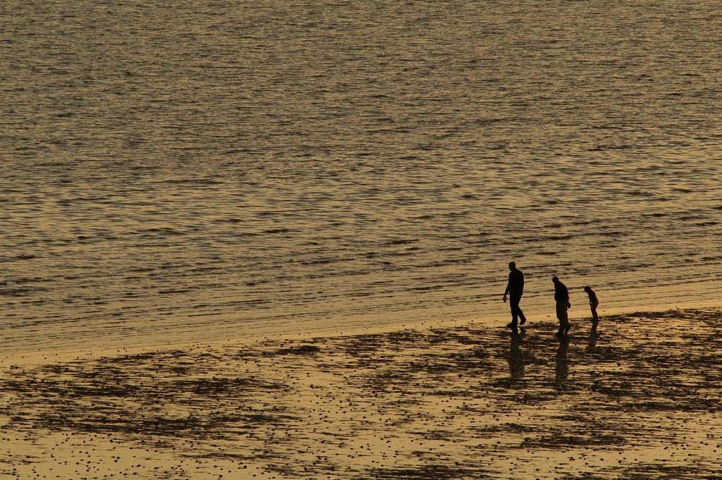
Image; Flimby. © Solway Firth Partnership

Transitional and coastal waters

Overall Status of Solway Water Bodies

On the Scottish side of the Solway there are 9 transitional and 8 coastal water bodies. The Inner Solway is the ‘Solway Estuary’ water body within the Scottish water body table below.

On the English side of the Solway, there is 1 coastal and 3 transitional water bodies.

The following tables show the overall status for Solway Firth coastal and transitional waterbodies in recent years.

Name and Water body Type

(C) Coastal

(T) Transitional

Year 
2007 2008 2009 2010 2011 2012 2013 2014 2015 2016 2017
Auchencairn Bay/Rough Estuary (T) Moderate Good Good Good Good Good Good Good Good Good Good
Balcary Point to Kirkcudbright Bay (C) Good Good Good Good High Good Good Good Good Good Good
Bladnoch and Cree Estuary (Outer) (T) Good High High High High High Good Good Good Good Good
Cree Estuary (T) High High High High High High High High High High High
Dee (Kirkcudbright) Estuary (T) Moderate High High High High High High High High High High
Fleet Estuary (T) Moderate Good Good Good Good Good Good Good Good Good Good
Luce Bay (C) High Good Good Good Good Good Good Good Good Good Good
Mull of Galloway to Corsewall Point (C) Moderate Good Good High High High Good Good Good Good Good
Piltanton and Luce Estuary (T) Good High High High High High High High High Good Good
Southerness Point to Balcary Point (C) Moderate Good Good Good Good Good Good Good Good Good Good
Solway Estuary (T) High Moderate Moderate Moderate Moderate Moderate Good Moderate Moderate Moderate Moderate
Solway Firth Offshore (C) Good Good Good Good High High High High Good High High
Southwick Estuary (T) Moderate High High High High High High High High High High
Wigtown Bay (C) High Good Good Good Good Good Good Good Good Good Good
Nith Estuary (T) (Heavily Modified)

Poor  Good Ecological Potential Good Ecological Potential Good Ecological Potential Good Ecological Potential Good Ecological Potential Good Ecological Potential Good Ecological Potential Good Ecological Potential Good Ecological Potential Good Ecological Potential
Loch Ryan (C)

Moderate

Moderate Moderate Moderate Moderate Moderate Good Good Good Good Good
Loch Ryan Offshore (C)

Moderate

Good Good High High High Good Good Good Good Good

Table Source; Scottish Environmental Protection Agency (n.d)


River basin district Management catchment Operational catchment Water body

(T) Transitional

(C) Coastal

Year

2009 2010 2011 2012 2013 2014 2015 2016
Solway Tweed Solway Tweed TraC Solway Firth Solway (T) Moderate Moderate Moderate Moderate Moderate Moderate Moderate Moderate
North West North West TraC North West Region Coastal Waters Solway Outer South (C) Moderate Moderate Moderate Moderate Good Good Moderate Moderate
Derwent Estuary Derwent (T) Designated as a heavily modified water body  Good Good Good Good Good Good Moderate Moderate
Ellen and West Coast Estuary Maryport (T) Designated as a heavily modified water body  Moderate Moderate Moderate Moderate Moderate Moderate Moderate Moderate

Table Sources; Classification Data for the Solway Tweed River Basin District (Environment Agency (n.d.b))  & North West River Basin District (Environment Agency (n.d.a))

Transitional and coastal waters

References

Baxter, J.M., Boyd, I.L., Cox, M., Donald, A.E., Malcolm, S.J., Miles, H., Miller, B., Moffat, C.F., (Editors), (2011). Scotland’s Marine Atlas: Information for the national marine plan. Marine Scotland, Edinburgh. pp 191. Available here. (Accessed: 22.07.19)

Marine Management Organisation. (n.d.). Marine Planning Evidence Base. Available here. (Accessed: 14.05.18)

Marine Scotland (n.d.). Scotland’s National Marine Plan Interactive. Available here. (Accessed: 06.08.19)

Mills, F., Sheridan, S. and Brown S. (2017). Clyde Marine Region Assessment. Clyde Marine Planning Partnership. pp 231, Available here. (Accessed: 14.05.18)

Scottish Environment Protection Agency (n.d.). River Basin Management Planning. Available here. (Accessed: 08.03.21)

Solway Firth Partnership (1996). The Solway Firth Review, Solway Firth Partnership, Dumfries. Available here. (Accessed: 23.07.19)


In-Text References;

Environment Agency (n.d.a) Classification Data for the North West River Basin District. Available here. (Accessed: 06.06.19)

Environment Agency (n.d.b) Classification Data for the Solway Tweed River Basin District. Available here. (Accessed: 06.06.19)

European Commission (n.d.) Introduction to the EU Water Framework Directive. Available here. (Accessed: 06.06.19)

Scottish Environment Protection Agency (n.d.). Water Classification Hub. Available here. (Accessed: 08.10.18)


Image; The River Nith. © G. Reid/ Solway Firth Partnership