Hazardous substances


Status of hazardous substances: No overall trend discernible with few or no concerns
 but some local concerns 

Status of radioactivity: No overall trend discernible with few or no concerns

(Baxter et al, 2011)

Status of contaminants: Improving situation since 2012

Status of contaminants in seafood; Improving situation since 2012

(United Kingdom Marine Monitoring & Assessment Strategy, n.d)

Some hazardous substances are naturally occurring in the marine environment such as small concentrations of cadmium, lead, mercury and Benzo[a]pyrene however their presence is increased through anthropogenic (human induced) sources and uses. The substances which occur naturally are also increased in the marine environment in larger quantities through human activities. There are also synthetic hazardous substances which can be introduced into the marine environment through anthropogenic sources. Releases of hazardous substances can travel over long distances, posing a threat to a large marine area, and across administrative boundaries throughout the UK and internationally. There are negative impacts on animals in the marine environment but also to humans either in the environment or through food we consume.


Image; Washed up flare bomb © Solway Firth Partnership. Photographer; K. Kirk

Hazardous substances

Background

Hazardous substances may be directly or indirectly released. Direct releases may be into water bodies upstream or into the marine environment through point source pollution and can include sewage discharges (see Water water and industrial outfalls and bathing waters) and spills (see Spills and accidents). Indirect releases can come from agricultural run-off (a key consideration for the Solway considering the agricultural areas surrounding the Firth), run-off from urban areas, rainfall and atmospheric deposition. Hazardous substances can be persistent in nature, and can accumulate in the marine environment. They pose an increasing threat as they build up over time (bioaccumulate) or as they concentrate and build up as they progress through food webs (biomagnify). Historic inputs may still pose a present threat due to this persistent nature. The significant issues of biomagnification of historic hazardous substances are highlighted by Lulu the killer whale. Lulu was stranded on Tiree, Scotland, in 2017 and ‘her body contained among the highest levels of polychlorinated biphenyls, or PCBs, ever recorded. The chemicals were banned from the 1970s but are still in the environment. Researchers now fear that other animals in Lulu’s pod also have similarly high levels of contamination’ (BBC News, 2017). Post mortems of cetaceans conducted by the UK Cetacean Strandings Investigation Programme (CSIP) can provide important information on the effects of hazardous substances on food webs and species (see Whales, dolphins and porpoises for more information on Solway cetaceans).

Negative impacts can be harmful to animals in the marine environment but also to humans, meaning that the UK’s vision for a ‘clean and safe’ marine environment is only possible with consideration of the threat of hazardous substances.

Negative impacts from hazardous substances pose a threat to the many features around the Solway Firth which have merited several conservation designations. Recovery or maintenance of features at favourable condition may be compromised by the effects of hazardous substances. Information provided in advice from both Natural England and NatureScot regarding the Solway European Marine Site (see the Protected Areas section for more information on the European Marine Site) provides the following information regarding toxic contamination in the Firth;

  • ‘All the sub-features of the estuary are considered both highly sensitive and potentially vulnerable to the effects of toxic contamination…many of the communities or species of the estuarine habitats are sensitive.
  • Heavy metals have a range of negative impacts on both animal and plant species, but the toxic effects on infaunal invertebrates, rocky scar communities and accumulation in saltmarsh grasses are of greatest concern.
  • Solway estuarine sub-features are all considered sensitive to oil. This is particularly true for Atlantic salt meadows and saltmarsh.
    • Particular attention should be given to both diffuse and point sources of oil within the estuary.’

(Natural England and NatureScot, 2010)

One of the most important issues to consider when discussing hazardous substances in the Solway is the close proximity to Sellafield. Sellafield is a nuclear site tasked with retrievals, remediation, spent nuclear fuel management and safe storage for special nuclear materials, owned by the Nuclear Decommissioning Authority. Sellafield has been a long-standing concern for the potential of hazardous substances in the Solway especially given the long-term legacy implications.

It is worth noting that hazardous substances is a complex and broad topic which goes beyond the discussion below. Many substances could be considered hazardous to the marine environment because in large quantities almost anything can be hazardous in some way.


Image; Boats on the Solway (Kirkcudbright). © Solway Firth Partnership. Photographer; Colin Tennant.

Hazardous substances

Types of hazardous substances

Humans use a variety of substances both natural and man-made which can give rise to issues through polluting the marine environment. Pollutants enter the marine environment from a variety of sources but are most often are from land-based sources.

Substance Substance information Common Sources Linked impacts
Polycyclic aromatic hydrocarbons (PAHs) Naturally occurring chemicals within coal, oil, petrol etc, but also released through the burning of organic materials such as oil, wood, petrol etc. Car emissions (resulting in atmospheric deposition)
road run-off, residential
industrial discharges (resulting in atmospheric deposition)
mutagenic (alters DNA)

carcinogenic (causes cancer)

Polychlorinated biphenyls (PCBs) Manufactured organic chemicals used in industrial/commercial applications. Closed uses of PCBs in new equipment was banned in 1981. There are limited exceptions, but overall in the UK PCBs are banned and equipment or material containing them must be disposed of. Transformers
Hydraulic fluids, Capacitors,
Plasticisers (paint, plastics, sealant)
Toxic to humans and animals, Endocrine disruption,
Immunosuppression,
Vitamin A deficiency
Polybrominated diphenyl ethers (PBDEs) An organobromine compound used in the production of flame retardants Historic; Manufacturing

Ongoing; Leaked from everyday use of treated household products

Unknown effects on humans


Animals; Endocrine disruptors, Can affect central nervous system and brain


Heavy metals (cadmium, mercury and lead) There are several other heavy metals which can be toxic, but cadmium, mercury and lead are of the most concern in the marine environment. Furthermore, heavy metals do not break down, making accumulation easier.  

Naturally occur in small concentrations


Anthropogenic; Sewage outfalls, Industrial outfalls, Agricultural run-off

Elevated concentrations with added input from anthropogenic sources; Long-term health effects (cadmium), Highly toxic (mercury)
Tri-Butyl-Tin (TBT) Used to protect hulls from fouling.

Phased out in 1988 for boats <25m, all international shipping by 2003. In 2008 a global ban came into effect for all boats. TBT is persistent and remains present in sediment.

Boat hulls Cause damage to many marine species, causes imposex in dog whelks.

Table Source; Information gathered from Mills et al (2017)

Hazardous substances

Radioactive Substances

Radioactive substances are hazardous to the environment and human health, so are regulated to help protect against negative impacts.

The Scottish Environment Protection Agency (SEPA) regulates the management of radioactive substances in Scotland, determines permits, monitors and undertakes emergency response.

SEPA regulates the disposal of radioactive waste from licensed nuclear sites and permits the keeping and use of radioactive substances and the accumulation and disposal of radioactive waste from non-nuclear industrial sites. In the event of an incident involving the release of radioactivity to the environment, it’s SEPA’s role to assess the impacts of the incident and advise on clean-up. Environmental authorisations are required at the level when substances require regulation, i.e. when they become ‘radioactive’. The Environmental Authorisations (Scotland) Regulations 2018 set out the levels at which this occurs. Regulation, management, and authorisations are the responsibility of SEPA, which issues authorisations and permits (there are 4 types of authorisation, permit is one of these types) under the Radioactive Substances Act 1993.

Further information about radioactive substance management and regulation is available at;

In England activities including radioactive substances require a permit from the Environment Agency which is responsible for radioactive substances regulation. Environmental permits are required for any activity which may pollute water (air or land), increase flood risk, or impact land drainage negatively.

Further information about radioactive substance management and regulation is available at;


The annual Radioactivity in Food and Environment (RIFE) Report covers the whole of the UK and is published collaboratively by the environmental regulators and food safety agencies. The RIFE report sets out the findings of the monitoring programmes of radioactivity in food and the environment carried out in the previous year throughout the UK by the UK’s environmental regulators and food safety agencies. It provides an open assessment of the public’s exposure to radiation and food safety checks. Monitoring checks the effects of discharge operations on food and the environment, assessing annual radiation doses, compared to relevant limits. Some datasets used in the production of the RIFE report may not be publicly available.

The UK also has the Radioactive Incident Monitoring Network (RIMNET). This is the nuclear radiation monitoring and nuclear emergency response system. This was originally established to monitor the consequences for the UK of nuclear incidents abroad.

According to the Department for Business, Energy & Industrial Strategy’s Radioactive incident monitoring collection; ‘The system is now utilised in the UK response to all major radiological events. Radiation dose rate readings (gamma plus cosmic) from [over 90] sites around the UK are collected every hour and checked for any indication of abnormal increase. Any readings of radiological significance for the UK would result in an alert being raised and investigated’ (Department for Business, Energy & Industrial Strategy, 2013).

SEPA is responsible for the Scottish portion of the RIMNET, and elaborates that; ‘following detection, [RIMNET] will support the on-going collection and analysis of radiological monitoring data relating to the accident and provide information concerning its effects, for distribution to the media, official agencies and the public’ (Scottish Environment Protection Agency, n.d.).

There is a RIMNET monitoring station in the Solway, at West Freugh. There is also a station at Carlisle as stations are not exclusively on the coast.

Hazardous substances

Hazardous substances in the Solway Firth

As well as the addition of new hazardous substances into the Solway, natural and anthropogenic activities carried out in the marine environment have the potential to remobilise contaminated sediments into the water column. Contaminant typesize of sediment particles and environmental factors, such as exposure to oxygen can all impact desorption rates and times.


Scotland

The Ministry of Defence (MOD) Dundrennan firing range includes a 31km2 sea danger area. For a period up until 2008, a number of depleted uranium shells were fired into the Solway during military exercises.

Beaufort’s Dyke, in the North Channel, was previously used as a munitions dump, with considerable material on the seabed surrounding the dyke as well as inside it. This poses a potential risk as some munitions contained phosgene gas which may still be present inside some munitions and will remain liquid at the Dykes depth pressure and temperature.

Chapelcross, located near Annan, was Scotland’s first commercial nuclear power station and has four Magnox reactors. Electricity generation ceased in 2004 and the station has been decommissioning since then. De-fuelling of the reactors was completed 2008-2013 and remaining major hazards continue to be addressed. Current plans are for the site to be de-licensed (released from regulatory control) with final site clearance to be achieved by 2095. The site continues to discharge radioactive effluent under authorisation through the Radioactive Substances Act 1993 (issued by SEPA). There is a liquid discharge pipe which exits into the Solway at Seafield (~6km from Chapelcross) into the Upper Solway Flats and Marshes Site of Special Scientific Interest/Ramsar and Solway Firth Special Protection Area/Special Area of Conservation sites (Magnox Limited, 2020). The Chapelcross site Environmental Management Plan (2020) outlines impacts from decommissioning phases and mitigation measures proposed to limit impacts.

As part of SEPAs comprehensive environmental monitoring programme for environmental radioactivity, habits surveys are conducted to understand how the public may be exposed to radioactivity. SEPA has a public report from 2017 which presents the findings of a Radiological Habits Survey at Chapelcross in 2015, covering the area between Glencaple and Gretna marine and intertidal areas and looking at exposure rates through a variety of pathways (available here). SEPA also conducts habits surveys in full every 5 years in the vicinity of Sellafield to explore exposure pathways of discharges (liquid, gas, direct) such as; consumption, activities and occupancy in intertidal areas and the Solway itself, intertidal land use, fishing gear/sediment handling, and natural resource use. These reports provide useful Solway specific information about the potential exposure of the public in Dumfries and Galloway but also about the survey areas and how the public use the Scottish Solway coast. An annual survey for liquid discharges, high-rate local fish and shellfish consumption, and intertidal occupancy rates occurs in the years between the full habits surveys. More information on the Sellafield surveys is provided below.


England

In 1729 Saltom Pit saw the start of deep under-sea mining. Men, women and children worked below the seabed to dig tunnels stretching 2km from shore creating a submarine city. There has been a legacy of Cumbria coal mining, with a coalfield extending along the coast from Whitehaven to Wigton. Haig Pit was sunk between 1914-18 and was the last deep coal mine in Cumbria when it closed in 1986. It was the end of the mining era in Whitehaven until West Cumbria Mining Ltd applied to reopen the former Marchon site (see Energy, aggregates, subsea cables and pipelines for more information).

Sellafield is a nuclear fuel reprocessing and decommissioning site near Seascale, Cumbria (south of the Solway) and forms one of the largest and ongoing concerns for hazardous substances within the Solway. Sellafield is unique and it is where many major developments in the 20th Century nuclear industry were pioneered. It is now owned by the Nuclear Decomissioning Authority.

It is home to:

  • The Windscale Piles, which were used to create material for weapons
  • The world’s first commercial-scale nuclear power station –Calder Hall, opened in 1956
  • The world’s first large-scale advanced gas-cooled reactor, opened in 1963
  • Nuclear fuel storage ponds and waste silos, built in the 1940s and 50s
  • Nuclear fuel fabrication plants
  • Nuclear fuel reprocessing plants
  • A fleet of nuclear waste storage facilities

Sellafield does continue to discharge low level nuclear waste into the marine environment, these discharges are strictly regulated by the Environment Agency (EA). These discharges are lower than they have been in the past due to the change of focus at the Sellafield site from reprocessing to decommissioning. This will occur when the Magnox fuel reprocessing plant closes this year (2021), and will take 100 years to complete. This was originally planned for 2020 but was halted due to COVID-19. Over many years, however, radioactive waste has been discharged into the Irish Sea, with the Irish Times reporting in 1998 that Greenpeace claimed; ‘Sellafield is pumping eight million litres of radioactive discharges into the Irish Sea every day‘ (The Irish Times, 1998).

The EA granted a variation of Sellafield’s environmental permit (came into effect October 2020) focussed on discharge limits, and ,among other variations, reduced site discharge limits and removed some discharge limits on the basis that discharges have dropped to such a degree that limits are not needed.

The EA imposes strict conditions on operators of nuclear sites such as Sellafield with environmental permits to ensure activities are not harmful, and strict discharge limits are set in Sellafield’s permit. Sellafield routinely monitors the beaches near the plant. Radioactive finds are removed from the beach and sent for analysis. This monitoring is focussed closer to Sellafield but has included areas in the Solway. The objects found relate to past events and incidents at Sellafield 25-40 years ago, with no ongoing discharges of radioactive particles or objects into the environment. Public health advice is that health risks from radioactive objects are very low and no action is needed to prevent or limit access to beaches affected by contamination (Environment Agency, 2021). Between 2006 and 2020 Sellafield Ltd found 18 particles and 1 larger object in the 113 hectares of area covered at Allonby in the Solway Firth. In this time there were a total of 2,611 particles and 724 larger objects found across all monitored sites (2,469 hectares).

Sellafield Ltd’s annual environmental and safety reports are available here.

There is a host of relevant information related to Sellafield within the RIFE report. The majority will not be repeated here as the reports are freely accessible and available online. Reading the most recent RIFE report is encouraged. There is regular monitoring of the marine environment, fish and shellfish, sediments, dose rates, fishing gear, contact dose rate of intertidal environments, seaweed, tide-washed pasture, waters, fishmeal, and unusual pathways, near Sellafield (and further afield) carried out by a variety of organisations. The RIFE report includes tables of results for 2019 which include Solway Firth sampling locations including;

  • beta/gamma radioactivity in fish from the Irish Sea vicinity and further afield (Table 2.5)
  • beta/gamma radioactivity in shellfish including from the Irish Sea vicinity and further afield (Table 2.6)
  • Concentrations of transuranic radionuclides in fish and shellfish from the Irish Sea vicinity and further afield (Table 2.7)
  • Concentrations of radionuclides in sediment from the Cumbrian coast and further afield (Table 2.8)
  • Gamma radiation dose rates over areas of the Cumbrian coast and further afield, including saltmarsh and sand (Table 2.9)
  • Concentrations of radionuclides in aquatic plants from the Cumbrian coast and further afield (Table 2.12)
    (Environment Agency et al, 2020).

There are a number of locations used for sampling for monitoring these aspects, and others, in both the Scottish and English Solway. For example, monitoring Gamma radiation dose rates over areas of the Cumbrian coast and further afield included sampling saltmarsh in Cumbria at Rockcliffe Marsh, Burgh Marsh, Port Carlisle, Newton Arlosh and in Scotland at Bladnoch, Kirkcudbright, Rascarrel Bay, Kippford -Merse, and Kippford Marsh. Other sites on the Scottish and English coast of the Solway were also locations for monitoring on ground types such as sand, rocks, sediment, winkle bed, stones, pebbles and sand, mud and sand, and shingle.

The reduction in aerial and liquid discharges from Sellafield over the last three decades has been significant, however exposure to radioactivity from the Sellafield site does still occur. People living around the Cumbrian coast (near Sellafield) and eating local seafood, and those eating food collected from the coast in Dumfries and Galloway, were the most exposed to radioactivity in 2019 in England and Scotland (Environment Agency et al, 2020). Although, it should be noted that these exposures were significantly below the legal limit at 24% of the legal limit, and 3% of the legal limit respectively (Environment Agency et al, 2020).

SEPA habits surveys are conducted in full every 5 years in the vicinity of Sellafield to explore exposure pathways of discharges (liquid, gas, direct). An annual survey for liquid discharges, high-rate local fish and shellfish consumption, and intertidal occupancy rates occurs in the years between the full habits surveys. Radiological Habits surveys were conducted by SEPA in 2012 and 2017 for the Dumfries and Galloway coast to determine consumption and occupancy rates by the public between the Isle of Whithorn and Caerlaverock National Nature Reserve (reports available here). In terms of radioactive substances including both Sellafield (derived aquatic pathways only) and Chapelcross, Scotland’s Marine Assessment (Moffat et al, 2020) had few or no concerns for the status of radioactive substances in the Solway, with a no/little change trend, with high confidence.

Whitehaven in particular has a legacy of hazardous substances as a result of the phosphate processing plant which discharged waste by pipeline to Saltom Bay. The site was demolished in 2004. The decay products of Technologically Enhanced Naturally Occurring Radioactive Material (slurry) discharges into the marine environment from this man-made source (non-nuclear) has ongoing effects. This is considered in the RIFE report as it continues to impact the annual ‘total doses’ of radiation. Exposure to source specific doses in the UK in 2019 were significantly higher for liquid wastes in the areas of Whitehaven and Sellafield. They receive a significant contribution to the dose from technologically enhanced naturally occurring radionuclides from previous non-nuclear industrial operations, but were still significantly under the dose limit of 1 mSv to members of the public (Environment Agency et al, 2020).


Image; Whitehaven © Solway Firth Partnership

Hazardous substances

Regulating and monitoring hazardous substances

Some hazardous substances can be removed, however many cannot, only reducing through degrading and dispersing over time. This means that accumulation of previous discharges of hazardous substances can continue to contribute to concentrations long past their discharge. Monitoring is important to ensure that new discharges, along with historic discharges, do not pose a risk to the marine environment and human health and action can be taken where they do. Shellfish, macroalgae, seagrass and saltmarsh have the potential to be used to bio-remediate environments with excess chemicals (Mills et al, 2017). As there is an ongoing shift in public awareness and drive towards renewable energy and reductions in discharges and waste, many of the effects felt today are due to past discharges and the persistent, semi-volatile character of some substances, many of which are now banned, as illustrated with the stranding of Lulu, mentioned above.

International

In 2004 The Stockholm Convention entered into force. This global treaty is designed to protect human health, initially by eliminating 12 of the most harmful Persistent Organic Pollutants (POPs) from the environment and supporting the transition to safer alternatives. The Stockholm Convention currently lists 28 POP substances or groups of substances and requires the environmentally sound waste management of PCBs by 2028.

The UK is also part of the legally binding Rotterdam Convention on the international trade of dangerous chemicals, which seeks to protect both human health and the environment from potential harm.

The Convention for the Protection of the Marine Environment of the North-East Atlantic (OSPAR) monitors substances which may be of possible concern to the marine environment. OSPAR also developed the ‘OSPAR Hazardous Substances Strategy’ aiming to progressively reduce discharges of hazardous substances, emissions and hazardous substance losses by identifying actions and measures to achieve the strategy objectives. The annual assessment of contaminants in biota and in sediment are available through the OSPAR contaminants app, here with data for the Solway Firth also available through the app. OSPAR identifies and maintains a List of OSPAR Chemicals for Priority Action and a List of Substances of Possible Concern (both of which are under substantial review in 2021/2022). The overall objective of the OSPAR Strategy is to achieve ‘near background values for naturally occurring substances and close to zero for man-made synthetic substances’ (OSPAR Hazardous Substances Strategy).

According to the OSPAR Commission website ‘OSPAR has developed a monitoring strategy that sets out the best way to collect data and information on sources, pathways, concentrations and effects, in order to track progress towards the strategic objectives for hazardous substances through annual assessments. This includes long-term data collection under the OSPAR monitoring programmes for:

  • atmospheric inputs (Comprehensive Atmospheric Monitoring Programme –CAMP)
  • riverine inputs and direct discharges (Comprehensive Study on Riverine Inputs and Directive Discharges –RID)
  • concentrations and effects in the marine environment (Coordinated Environmental Monitoring programme –CEMP)’ (OSPAR, n.d.)

OSPAR – Discharge Monitoring Points in Scotland are available through data layers in the National Marine Plan Interactive, available here.

OSPAR Intermediate assessments from 2017 on contaminants are available here

According to Baxter (et al, 2011) ‘the OSPAR Strategy is implemented through the UK Strategy for Radioactive Discharges 2009, which provides a strategic framework for reducing discharges from the nuclear industry’. This strategy was reviewed in 2018 by the ‘UK strategy for radioactive discharges 2018 review of the 2009 strategy’ policy paper, and concluded that the UK was making good progress to achieving the outcomes of the 2009 strategy, and that the UK is contributing towards meeting the objectives of the OSPAR Strategy.


European Union

The Marine Strategy Framework Directive (MSFD) means the UK seeks to achieve Good Environmental Status (GEnvS). There are 11 ‘descriptors’ for what GEnvS will look like in the marine environment once it has been achieved, including; concentrations of contaminants cause no effect (descriptor 8) and contaminants in seafood are below safe levels (descriptor 9). The UK has largely achieved its aim of GEnvS for both contaminants and contaminants in seafood (United Kingdom Marine Monitoring & Assessment Strategy, n.d.) with target thresholds generally being met, and a high level of compliance with safety rules, respectively (United Kingdom Marine Monitoring & Assessment Strategy, n.d.). See the UK Marine Online Assessment Tool for contaminants and contaminants in seafood for more information.

EU regulation of chemical pollutants in water began with the Dangerous Substances Directive (76/464/EEC), which has been integrated into the Water Framework Directive (WFD) (2000/60/EC). As discussed in several other sections of the Solway Review the WFD (2000) sets out strategies against pollution in water and seeks to achieve ‘Good Ecological Status’ (GEcS) in coastal and transitional waters (as well as ground and surface waters). The WFD recognises the need for European level measures to tackle water pollution through pollutants. As such, the WFD outlines steps to be taken and production of a list of priority substances which pose a threat to the aquatic environment, to be prioritised for action by 2021. The Commission is also to outline proposals for progressive reduction and phasing out of discharges, emissions and losses of the priority substances, as well as establishing quality standards for the concentrations of the substances in surface water, sediments, and biota. The list of priority substances was first established in Decision No 2455/2001/EC. The Environmental Quality Standards Directive (EQSD) (2013/39/EU) addresses the chemical status of surface waters in Europe, and replaced the list of priority substances in Decision 2455. The EQSD defines environmental quality standards for priority substances in rivers, lakes, coastal and transitional waters. Action is required with the view to meeting the quality standards set out in the objectives of the EQSD.

Regulation (EU) 2019/1021 bans/restricts manufacturing, marketing and use of POPs in the EU. The Regulation has 4 lists of substances in Annex I, II, III and IV subject to elimination, restriction, reduction, and waste management. Among other requirements the regulations require member states to identify and remove equipment containing more than 0.005% PCBs and volumes greater than 0.05 dm3 by 31 December 2025. This requirement has been implemented through The Environmental Protection (Disposal of Polychlorinated Biphenyls and other Dangerous Substances) (England and Wales) (Amendment) Regulations 2020 and The Environmental Protection (Disposal of Polychlorinated Biphenyls and other Dangerous Substances) (Scotland) (Amendment) Regulations 2020.


Image; Knockbrex, Bathing House Bay. © Solway Firth Partnership

Hazardous substances

UK Clean Seas Environmental Monitoring Programme

The main UK monitoring programme is the coordinated approach to environmental monitoring provided by the UK Clean Seas Environment Monitoring Programme (CSEMP). CSEMP fulfils the mandatory monitoring requirements set by OSPAR Coordinated Environmental Monitoring Programme (CEMP) and the UK’s commitment to European directives across the UK (such as the WFD and the MSFD).


We are currently updating this information page on the CSEMP.


Image; Brighouse Bay © Solway Firth Partnership

Hazardous substances

References

BBC (2013). Dundrennan depleted uranium protest staged. Available here. (Accessed: 06.08.18)

Colourful Coast (2018). Saltom Pit. Available here. (Accessed: 30.05.18)

Eggleton J., Thomas K. V. (2004). A review of factors affecting the release and bioavailability of contaminants during sediment disturbance events. Environment International 30 (7) 973–980. Available here. (Accessed: 30.05.18)

Environment Agency, Food Standards Agency, Food Standards Scotland, Natural Resources Wales, Northern Ireland Environment Agency, Scottish Environmental Protection Agency (2015). Radioactivity in food and the environment, 2014. Available here. (Accessed: 30.05.18)

European Environment Agency (2019). Indicator Assessment, Hazardous substances in marine organisms. Available here. (Accessed: 12.06.21)

European Environment Agency (2019). Indicator Specification, Hazardous substances in marine organisms. Available here. (Accessed: 12.06.21)

Food Standards Agency (2017). Shellfish controls information. Available here. (Accessed: 28.05.18)

Food Standards Scotland (2015). Shellfish safety and sanitationAvailable here. (Accessed: 28.05.18)

Garrod, C.J., Clyne, F.J., Ly, V.E. and Papworth, G.P., 2013. Radiological Habits Survey: Dumfries and Galloway Coast, 2012. RL 25/13. Cefas, Lowestoft. Available here. (Accessed: 22.07.21)

Industrial History of Cumbria (2011). Coal. Available here. (Accessed: 30.05.18)

Marine Management Organisation. (n.d). Marine Planning Evidence Base. Available here. (Accessed: 14.05.18)

Marine Scotland (n.d.). Scotland’s National Marine Plan Interactive. Available here. (Accessed: 06.08.19)

Moore, K.J., Greenhill, B.J. and Clyne, F.J. (2020). Radiological Habits Survey: Sellafield Review, 2019. Review of shellfish and fish consumption, and intertidal occupancy. Cefas contract report C7325. Environment Report RL 03/20. Cefas, Lowestoft. Available here (Direct Download). (Accessed: 06.04.21)

Nuclear Decommissioning Authority (2018). Nuclear provision: the cost of cleaning up Britain’s historic nuclear sites. Available here. (Accessed: 07.08.18)

Sellafield Ltd (2017). Monitoring our environment. Discharges and environmental monitoring. Annual report 2016. Available here. (Accessed: 29.05.18)

Smith, P., Dale, I., Tyler, A., Copplestone, D., Varley, A., Bradley, S., Bartie, P., Clarke, M. & Blake, M. (2017). Radiological Habits Survey: Dumfries and Galloway Coast. Available here. (Accessed: 10.05.21)

Solway Firth Partnership (1996). The Solway Firth Review, Solway Firth Partnership, Dumfries. Available here. (Accessed 23.07.19)

UK National Ecosystem Assessment (2011). The UK National Ecosystem Assessment Technical Report. UNEP-WCMC, Cambridge. Available here. (Accessed: 28.05.18)


In-Text References;

Baxter, J.M., Boyd, I.L., Cox, M., Donald, A.E., Malcolm, S.J., Miles, H., Miller, B., Moffat, C.F., (Editors), (2011). Scotland’s Marine Atlas: Information for the national marine plan. Marine Scotland, Edinburgh. pp 191. Available here. (Accessed: 22.07.19)

BBC News (2017). ‘Shocking’ levels of PCB chemicals in UK killer whale Lulu. Available here. (Accessed: 22.07.19)

Department for Business, Energy & Industrial Strategy (2013). Radioactive incident monitoring. Available here. (Accessed: 22.03.21)

Environment Agency, Food Standards Agency, Food Standards Scotland, Natural Resources Wales, Northern Ireland Environment Agency and the Scottish Environment Protection Agency. (2020). Radioactivity in Food and the Environment, 2019. Available here. (Accessed: 10.04.21)

Environment Agency (2021). Monitoring beaches near Sellafield for radioactive material. Available here. (Accessed 22.04.21)

Magnox Limited (2020). Chapelcross Site Environmental Management Plan. Available here. (Accessed: 21.06.21)

Moffat, C., Baxter, J., Berx, B., Bosley, K., Boulcott, P., Cox, M., Cruickshank, L., Gillham, K., Haynes, V., Roberts, A., Vaughan, D., & Webster, L. (Eds.). (2020). Scotland’s Marine Assessment 2020. Scottish Government. Available here. (Accessed: 10.04.21)

Mills, F., Sheridan, S. and Brown S., (2017). Clyde Marine Region Assessment. Clyde Marine Planning Partnership. pp 231, Available here. (Accessed: 14.05.18)

Natural England and NatureScot (2010). Natural England and Scottish Natural Heritage (now NatureScot) advice for the Solway European marine site given in compliance with Regulation 33(2) and in support of the implementation of the Conservation (Natural Habitats &c.) Regulations 1994. Available here (Direct download). (Accessed: 15.12.20)

OSPAR (n.d.) Hazardous Substances. Available here. (Accessed: 15.04.21)

Scottish Environment Protection Agency (n.d.). Emergency response planning. Available here. (Accessed: 15.04.21)

The Irish Times (1998). Sellafield’s nuclear pollution of the Irish Sea took decades to achieve. Available here. (Accessed: 15.04.21)

Tyler, A. Watterson, I. Dale, P. Smith, L. Evans, D. Copplestone, A. Varley, V. Peredo- Alverez, S. Bradley, B. Shaw, P. Bartie and P. Hunter. (2017). Radiological habitats survey: Chapelcross 2015. SEPA Public Report. Available here. (Accessed:16.06.21)

United Kingdom Marine Monitoring & Assessment Strategy (n.d) Summary of Progress towards Good Environmental Status. Available here. (Accessed: 15.12.20)


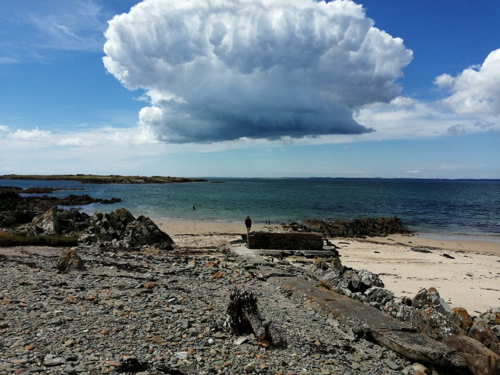
Image; Portling with Robin Rigg in the distance. © Solway Firth Partnership